DriveOhio Unveils Strategic Plan for Drone Research
By Bruce Edwards
Dive Brief:
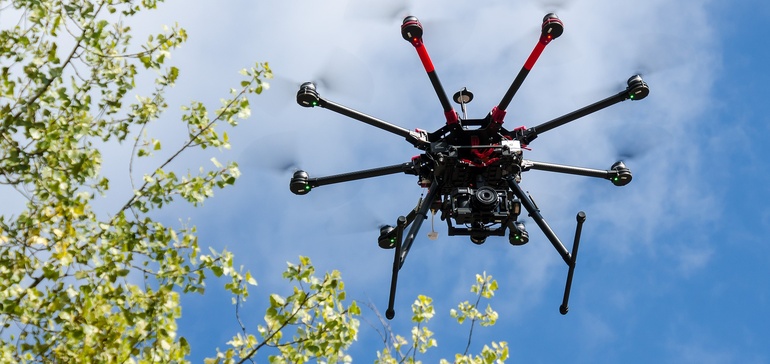
- DriveOhio, the state’s autonomous vehicle research office, announced a strategic partnership with the Ohio UAS (Unmanned Aircraft Systems) Center to research how drones can fit into smart air and ground traffic control.
- The strategic plan will have three main initiatives, including the development of an unmanned traffic management system to integrate delivery and transport on drones called FlyOhio. The partnership will also look at the business service applications of UAS like data collection and aerial photography, as well as a workforce development program to create smart mobility jobs around the technology.
- "UAS technology is advancing just as quickly as autonomous and connected vehicle technology, and Ohio understands how both can work together across multiple smart mobility initiatives," said Jim Barna, executive director of DriveOhio, in a press release. "Companies operating new UAS technologies need opportunities to test and deploy them, and the nation needs a traffic management system that can make drone package delivery and transportation safe and commercially viable. We aim to do all of this in Ohio."
Dive Insight:
There’s increasing interest in using drones to handle package deliveries to take more vehicles off the roads, reducing congestion and potentially speeding up delivery of vital medical supplies. The Federal Aviation Administration (FAA) is currently overseeing 10 projects in its UAS Integration Pilot Program (IPP), including a pilot in Reno, NV to deliver medical supplies by drone. San Diego has even been working with Uber to explore food delivery by drone, since that would clear up valuable curb space for its delivery vehicles.
But to get there, governments will need to come up with a traffic plan to manage thousands of aircraft, an effort still in its early stages given the tight regulations around drones. The FAA project is meant to gather data on how the delivery drones operate to write future rules. The Ohio partnership will explore an airspace management plan that can accommodate drones within federal regulations that require they fly at less than 2,000 feet. The partnership will also identify vertiports, or locations that can handle vertical takeoff and landing.
Through FlyOhio, the two agencies will work with the Air Force Research Laboratory to research SkyVision, a $5 million ground-based radar system to handle drone traffic at the Springfield-Beckley Municipal Airport. FlyOhio will also use a 35-mile stretch of highway between Dublin and East Liberty, OH that’s already a testing ground for autonomous vehicles to explore another traffic management system.
Ohio has tried to position itself as a leader on mobility research, especially through the Smart Columbus initiative; the latest partnership will show how drones fit into a broader smart mobility plan.